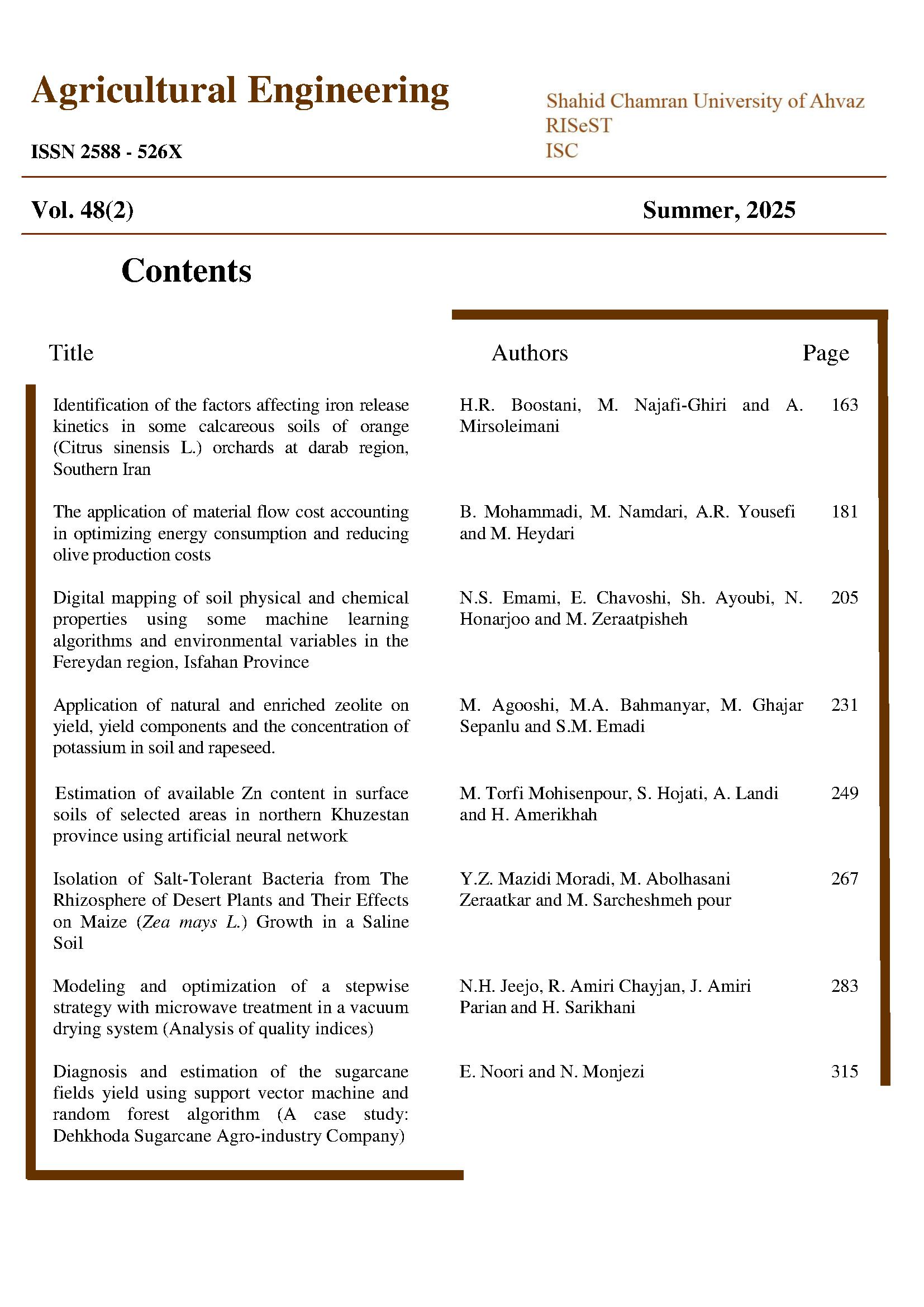
Digital mapping of soil physical and chemical properties using some machine learning algorithms and environmental variables in the Fereydan region, Isfahan Province

Document Type : Applicable

Authors

1 Ph.D. student, Department of Soil Science, College of Agriculture, Isfahan (Khorasgan) Branch, Islamic Azad University, Isfahan, Iran.

2 Associate Professor, Department of Soil Science, College of Agriculture, Isfahan (Khorasgan) Branch, Islamic Azad University, Isfahan, Iran.

3 Professor, Department of Soil Science, College of Agriculture, Isfahan University of Technology, Isfahan, 841568311, Isfahan, Iran.

4 Associate Professor, Department of Soil Science, Gund Institute for Environment, University of Vermont, 210 Colchester Ave, Burlington, VT 05401, USA.

Abstract
Introduction: Soil physical and chemical properties play critical roles in soil health, agricultural productivity, and natural resource management. These properties are key indicators for assessing soil sustainability and carbon storage. Understanding their spatial distribution is essential for effective land management and resource modeling, particularly within the context of sustainable agriculture. The mean weight diameter of soil aggregates (MWD) is a crucial functional parameter that significantly influences the carbon cycle, soil structural stability, and agricultural productivity. Similarly, soil organic carbon (SOC) plays a vital role in environmental sustainability. Digital soil mapping (DSM), which integrates data from environmental covariates and machine learning (ML) algorithms, is a powerful tool for predicting soil properties and enhancing sustainable land management practices. The DSM techniques have proven highly effective in estimating soil parameters across diverse landscapes, minimizing the need for extensive field surveys and enabling data-driven decision-making in precision agriculture. The primary objective of this study was to predict the spatial distribution of MWD and SOC using DSM. Additionally, this study aimed to rank the most influential environmental variables affecting these properties through ML-based modeling and compare the performance of various ML methods.

Materials and Methods: This study was conducted in the Fereydan region (50º 6' E, 32º 56' N), Isfahan Province, Iran. A total of 100 surface soil samples (0 to 20 cm depth) were collected from various land uses, including irrigated croplands, dryland farms, and pastures, using a systematic sampling network. The collected samples were air-dried, sieved through a 2 mm mesh, and then subjected to laboratory analyses. Six ML algorithms—artificial neural network (ANN), random forest (RF), cubist model, support vector machines (SVM), k-nearest neighbors (KNN), and boosted regression trees (BRT)—were employed to relate environmental variables to the soil properties under investigation. For the modeling process, four datasets were used as predictor environmental covariates: remote sensing data, topography derived from a digital elevation model (DEM), soil properties, and classified land data. The models' accuracy was evaluated across four different scenarios, each using one or more of these datasets. The most suitable environmental variables were selected through a multicollinearity test using the variance inflation factor (VIF). Finally, to model the two soil properties, the dataset was divided into calibration (70%) and validation (30%) subsets. The models' performance was evaluated using various statistical metrics, including the coefficient of determination (R²), root mean square error (RMSE), and mean absolute error (MAE).

Results and Discussion: The results of model validation revealed that the highest prediction accuracy for MWD was achieved using the KNN model in the fourth scenario (R²=0.59, RMSE=0.19, MAE=0.16). These values indicate a moderate yet significant ability of the KNN model to predict MWD. In contrast, for SOC, the cubist model in the fourth scenario yielded the highest accuracy (R²=0.78, RMSE=4.12, MAE=3.53). These results suggest that the cubist model was particularly effective in capturing the complex relationships between environmental variables and SOC, providing a robust framework for predicting soil carbon content. These findings highlight the strong potential of ML models to capture the intricate interactions between soil properties and environmental factors, allowing for precise spatial predictions of soil characteristics. The ability of these models to process large volumes of data and uncover hidden patterns is particularly useful in soil science, where the relationship between soil properties and environmental variables can be complex and nonlinear. The results also revealed that different environmental variables played varying roles in explaining the spatial variability of MWD and SOC. For MWD prediction, silt content was found to be the most influential variable, followed by VV and CHND, both of which were also significant factors affecting the spatial distribution of MWD. In contrast, for SOC prediction, the most important variables were the multi-resolution valley bottom flatness index (MRVBF) and clay content. These factors are critical for understanding the storage and cycling of organic carbon in soil, as both moisture retention and clay particles are known to influence the stabilization of soil organic matter. The relationship between these variables and SOC highlights the importance of considering soil texture and moisture dynamics when predicting soil carbon stocks.

Conclusion: The results of this study demonstrated that ML models, such as cubist and KNN can effectively predict soil quality properties across different regions, particularly when combined with topographic and climatic data. These approaches offer an efficient and rapid method for generating digital soil maps and supporting sustainable land management. By leveraging multiple environmental datasets, ML-based DSM enhances soil modeling accuracy while reducing reliance on extensive soil sampling. These models are especially useful in areas with similar climates where full-scale soil sampling may not be feasible, providing a valuable tool for estimating soil quality attributes and enhancing agricultural productivity. Ultimately, the findings of this research can help policymakers and farmers identify critical areas and adopt optimal strategies to improve soil quality and mitigate adverse environmental impacts. To further improve the accuracy and stability of predictions, future studies should incorporate high-resolution spatiotemporal data, advanced algorithms such as cubist and KNN, and dynamic models for analyzing temporal variations. Additionally, investigating soil–water–plant interactions and assessing the impacts of climate change could play a crucial role in enhancing agricultural productivity and promoting the sustainable management of soil resources.

Keywords

Subjects

  1. Amir Abedi, H., Asghari, S.A., Mesri Ghandomshin, T., and Balandeh, N. 2016. Prediction of mean weight diameter of aggregates using artificial neural network and regression models. Applied Soil Research, 4(1): 39-53. (In Persian with English Abstract)
  2. Asghari, S., Heidari, K., Hasanpour Kashani, M., and Shahab Arkhazloo, H. 2025. Evaluation of regression and intelligent models for estimating mean weight diameter of wet aggregates. Water and Soil, 38(5): DOI: 10.22067/jsw.2025.91071.1454. (In Persian with English Abstract)
  3. Cho, K.H., Beon, M.S., and Jeong, J.C. 2018. Dynamics of soil salinity and vegetation in a reclaimed area in Saemangeum, Republic of Korea. Geoderma. 321: 42–51. DOI: 10.1016/j.geoderma.2018.01.031.
  4. Dai, L., Wang, Z., Zhuo, Z., Ma, Y., Shi, Z., and Chen, S. 2025. Prediction of soil organic carbon fractions in tropical cropland using a regional visible and near-infrared spectral library and machine learning. Soil and Tillage Research, 245: 106297. DOI: 10.1016/j.still.2024.106297.
  5. Dharumarajan, S., and Hegde, R. 2022. Digital mapping of soil texture classes using Random Forest classification algorithm. Soil Use and Management, 38(1): 135-149. DOI: 10.1111/sum.12668.
  6. Emami, N.S., Chavoshi, E., Ayoubi, S., Honarjoo, N., and Zeraatpisheh, M. 2024. Comprehensive assessment of soil quality in various land uses: a comparative analysis of soil quality index models. Environmental Earth Sciences, 83(17): 498.
  7. Ghavami, M.S., Ayoubi, S., Mosaddeghi, M.R., and Naimi, S. 2023. Digital mapping of soil physical and mechanical properties using machine learning at the watershed scale. Journal of Mountain Science, 20(10): 2975-2992. DOI: 10.1007/s11629-023-8056-z.
  8. Guo, L., Fu, P., Shi, T., Chen, Y., Zhang, H., Meng, R., and Wang, S. 2020. Mapping field-scale soil organic carbon with unmanned aircraft system-acquired time series multispectral images. Soil and Tillage Research, 196: 104477. DOI: 10.1016/j.still.2019.104477.
  9. Hinge, G., Surampalli, R.Y., and Goyal, M.K. 2018. Prediction of soil organic carbon stock using digital mapping approach in humid India. Environmental Earth Sciences, 77: 1-10. DOI: 10.1007/s12665-018-7374-x.
  10. Jiang, L. 2021. A fast and accurate circle detection algorithm based on random sampling. Future Generation Computer Systems, 123: 245-256.
  11. John, K., Abraham Isong, I., Michael Kebonye, N., Okon Ayito, E., Chapman Agyeman, P., and Marcus Afu, S. 2020. Using machine learning algorithms to estimate soil organic carbon variability with environmental variables and soil nutrient indicators in an alluvial soil. Land, 9(12): 487. DOI: 10.3390/land9120487.
  12. Kemper, W., and Rosenau, R. 1986. Aggregate stability and size distribution. In: Klute A (Ed) Methods of soil analysis: Part 1 Physical and mineralogical methods, Wiley, 5: 425-442. DOI: 10.2136/sssabookser5.1.2ed.c17.
  13. Khaledian, Y., and Miller, B.A. 2020. Selecting appropriate machine learning methods for digital soil mapping. Applied Mathematical Modelling, 81: 401-418. DOI: 10.1016/j.apm.2019.12.016.
  14. Khordehbin, S., Hojatia, S.A.E.I.D., Landi, A., and Ahmadianfar, I. 2020. Comparison of different data mining methods in predicting soil organic carbon storage in some lands of Behbahan city. Iranian Journal of Soil and Water Research, 51(4): 1041-1054. DOI: 10.22059/ijswr.2020.288526.668308. (In Persian with English Abstract)
  15. Khormali, F., Ajami, M., Ayoubi, S., Srinivasarao, C., and Wani, S.P. 2009. Role of deforestation and hillslope position on soil quality attributes of loess-derived soils in Golestan province, Iran. Agriculture, Ecosystems and Environment, 134(3-4): 178-189. DOI: 10.1016/j.agee.2009.06.017.
  16. Khosravani, P., Baghernejad, M., Moosavi, A.A., and Rezaei, M. 2023. Digital mapping and spatial modeling of some soil physical and mechanical properties in a semi-arid region of Iran. Environmental Monitoring and Assessment, 195(11): 1367. DOI: 10.1007/s10661-023-11980-6.
  17. Khosravi, V., Gholizadeh, A., Kodešová, R., Agyeman, P.C., Saberioon, M., and Borůvka, L. 2025. Visible, near-infrared, and shortwave-infrared spectra as an input variable for digital mapping of soil organic carbon. International Soil and Water Conservation Research, 13(1): 203-214. DOI: 10.1016/j.iswcr.2024.10.002.
  18. Lamichhane, S., Kumar, L., and Wilson, B. 2019. Digital soil mapping algorithms and covariates for soil organic carbon mapping and their implications: A review. Geoderma, 352: 395-413. DOI: 10.1016/j.geoderma.2019.05.031.
  19. Ließ, M., Schmidt, J., and Glaser, B. 2016. Improving the spatial prediction of soil organic carbon stocks in a complex tropical mountain landscape by methodological specifications in machine learning approaches. PLOS One, 11(4): e0153673. DOI: 10.1371/journal.pone.0153673.
  20. Loiseau, T., Chen, S., Mulder, V.L., Dobarco, M.R., Richer-de-Forges, A.C., Lehmann, S., ... and Arrouays, D. 2019. Satellite data integration for soil clay content modelling at a national scale. International Journal of Applied Earth Observation and Geoinformation, 82: 101905. DOI: 10.1016/j.jag.2019.101905.
  21. Mahmoudzadeh, H., Matinfar, H.R., and Taghizadeh, M.R. 2021. Digitization of soil organic carbon with artificial neural network and multivariate linear regression in Kurdistan province. Journal of Soil Management and Sustainable Production, 10(4): 77-98. (In Persian with English Abstract)
  22. Maleki, S., Karimi, A., Mousavi, A., Kerry, R., and Taghizadeh-Mehrjardi, R. 2023. Delineation of soil management zone maps at the regional scale using machine learning. Agronomy, 13(2): 445. DOI: 10.3390/agronomy13020445.
  23. Meliho, M., Boulmane, M., Khattabi, A., Dansou, C.E., Orlando, C.A., Mhammdi, N., and Noumonvi, K.D. 2023. Spatial prediction of soil organic carbon stock in the Moroccan High Atlas using machine learning. Remote Sensing, 15(10): 2494. DOI: 10.3390/rs15102494.
  24. Naimi, S., Ayoubi, S., Zeraatpisheh, M., and Dematte, J.A.M. 2021. Ground observations and environmental covariates integration for mapping of soil salinity: a machine learning-based approach. Remote Sensing, 13(23): 4825. DOI: 10.3390/rs13234825.
  25. Nelson, R. 1983. Carbonate and gypsum. In: Page AL (ed) Methods of soil analysis: Part 2 Chemical and microbiological properties, Wiley, 9: 181-197. DOI: 10.2134/agronmonogr9.2.2ed.c11.
  26. Nozari, S., Pahlavan-Rad, M.R., Brungard, C., Heung, B., and Boruvka, L. 2024. Digital soil mapping using machine learning-based methods to predict soil organic carbon in two different districts in the Czech Republic. Soil and Water Research, 19(1): 32-49. DOI: 10.17221/119/2023-SWR.
  27. Nussbaum, M., Spiess, K., Baltensweiler, A., Grob, U., Keller, A., Greiner, L., Schaepman, M.E., and Papritz, A. 2018. Evaluation of digital soil mapping approaches with large sets of environmental covariates. Soil, 4(1): 1-22. DOI: 10.5194/soil-2017-14.
  28. Qiu, Y.L., Chen, C., Han, J., Wang, X.T., Wei, S.Y., and Zhang, Z.T. 2019. Satellite remote sensing estimation model of soil salinity in Jiefangzha irrigation under vegetation coverage. Water Saving Irrigation, 0(10): 108-112
  29. Rahimi Ashjerdi, M., and Ayoubi, S. 2013. Impacts of land use change and slope positions on some soil properties and magnetic susceptibility in Ferydunshahr district, Isfahan province. Water and Soil, 27(5): 882-895. DOI: 10.22067/jsw.v0i0.31182. (In Persian with English Abstract)
  30. Rahimi mashkale, M., Delavar, M. A., jamshidi, M., and sharififar, A. 2023. Improving the classification of soil imbalanced data using machine learning algorithms in some part of Zanjan provice land. Agricultural Engineering, 46(1): 61-82. DOI: 10.22055/agen.2023.43838.1667. (In Persian with English Abstract)
  31. Rahmati, F., Rngzan, K., and Landi, A. 2024. Modelling and digitally mapping of surface soil organic carbon in Semirom county employing several machine learning algorithms. Agricultural Engineering, 47(4): 585-605. DOI: 10.22055/agen.2024.47815.1740. (In Persian with English Abstract)
  32. Sahraei, N., Landi, A., and Hojati, S. 2022. Digital mapping of soil texture components in part of Khuzestan plain lands using machine learning models. Iranian Journal of Soil and Water Research, 53(10): 2261-2276. DOI: 10.22059/ijswr.2022.348442.669360. (In Persian with English Abstract)
  33. Scull, P., Franklin, J., and Chadwick, O.A. 2005. The application of classification tree analysis to soil type prediction in a desert landscape. Ecological Modelling, 181(1): 1-15. DOI: 10.1016/j.ecolmodel.2004.06.036.
  34. Siewert, M.B. 2018. High-resolution digital mapping of soil organic carbon in permafrost terrain using machine learning: a case study in a sub-Arctic peatland environment. Biogeosciences, 15(6): 1663-1682. DOI: 10.5194/bg-15-1663-2018.
  35. Soil Survey Staff. 2014. Keys to Soil Taxonomy, 12nd USDA-Natural Resources Conservation Service, Washington, DC.
  36. Tajik, S., Ayoubi, S., and Zeraatpisheh, M. 2020. Digital mapping of soil organic carbon using ensemble learning model in Mollisols of Hyrcanian forests, northern Iran. Geoderma Regional, 20: e00256. DOI: 10.1016/j.geodrs.2020.e00256.
  37. Tsui, C.C., Tsai, C.C., and Chen, Z.S. 2013. Soil organic carbon stocks in relation to elevation gradients in volcanic ash soils of Taiwan. Geoderma, 209: 119-127. DOI: 10.1016/j.geoderma.2013.06.013.
  38. Vaudour, E., Gomez, C., Fouad, Y., and Lagacherie, P. 2019. Sentinel-2 image capacities to predict common topsoil properties of temperate and Mediterranean agroecosystems. Remote Sensing of Environment, 223: 21-33. DOI: 10.1016/j.rse.2019.01.006.
  39. Wadoux, A.M.C., Minasny, B., and McBratney, A.B. 2020. Machine learning for digital soil mapping: Applications, challenges and suggested solutions. Earth-Science Reviews, 210: 103359. DOI:1016/j.earscirev.2020.103359.
  40. Walkley A., and Black, I.A. 1934. An examination of the Degtjareff method for determining organic carbon in soils: effect of variations in digestion conditions and of inorganic soil constituents. Soil Science, 63: 251-263. DOI: 10.1097/00010694-194704000-00001.
  41. Were, K., Bui, D.T., Dick, O.B., and Singh, B.R. 2015. A comparative assessment of support vector regression, artificial neural networks, and random forests for predicting and mapping soil organic carbon stocks across an Afromontane landscape. Ecological Indicators, 52: 394-403. DOI: 10.1016/j.ecolind.2014.12.028.
  42. Yang, R.M., Zhang, G.L., Liu, F., Lu, Y.Y., Yang, F., Yang, F., Yang, M., Zhao, Y.G., and Li, D.C. 2016. Comparison of boosted regression tree and random forest models for mapping topsoil organic carbon concentration in an alpine ecosystem. Ecological Indicators, 60: 870-878. DOI: 10.1016/j.ecolind.2015.08.036.
  43. Ye, Z., Sheng, Z., Liu, X., Ma, Y., Wang, R., Ding, S., Liu, M., Li, Z., and Wang, Q. 2021. Using machine learning algorithms based on GF-6 and Google Earth engine to predict and map the spatial distribution of soil organic matter content. Sustainability, 13(24): 14055. DOI:3390/su132414055.
  44. Ye, L., Tan, W., Fang, L., and Ji, L. 2019. Spatial analysis of soil aggregate stability in a small catchment of the Loess Plateau, China: II. Spatial prediction. Soil and Tillage Research, 192: 1-11. DOI: 10.1016/j.still.2019.03.009.
  45. Zeraatpisheh, M., Ayoubi, S., Jafari, A., Tajik, S., and Finke, P. 2019. Digital mapping of soil properties using multiple machine learning in a semi-arid region, central Iran. Geoderma, 338915: 445-452. DOI:1016/j.geoderma.2018.09.006.
  46. Zeraatpisheh, M., Ayoubi, S., Mirbagheri, Z., Mosaddeghi, M.R., and Xu, M. 2021. Spatial prediction of soil aggregate stability and soil organic carbon in aggregate fractions using machine learning algorithms and environmental variables. Geoderma Regional, 27: e00440. DOI: 10.1016/j.geodrs.2021.e00440.
  47. Zhou, T., Geng, Y., Chen, J., Pan, J., Haase, D., and Lausch, A. 2020. High-resolution digital mapping of soil organic carbon and soil total nitrogen using DEM derivatives, Sentinel-1 and Sentinel-2 data based on machine learning algorithms. Science of The Total Environment, 729: 138244. DOI: 10.1016/j.scitotenv.2020.138244.
  48. Zhou, T., Geng, Y., Ji, C., Xu, X., Wang, H., Pan, J., ... and Lausch, A. 2021. Prediction of soil organic carbon and the C: N ratio on a national scale using machine learning and satellite data: A comparison between Sentinel-2, Sentinel-3 and Landsat-8 images. Science of The Total Environment, 755: 142661. DOI:1016/j.scitotenv.2020.142661.
  49. Zhou, Y., Ma, H., Xie, Y., Jia, X., Su, T., Li, J., and Shen, Y. 2020. Assessment of soil quality indexes for different land use types in typical steppe in the loess hilly area, China. Ecological Indicators, 118: 106743. DOI: 10.1016/j.ecolind.2020.106743.
  50. Zolfaghari, A.A., Yazdani, M.R., Khosravi. M., and Mahmoudi S.M. 2019. Comparison of different data mining methods for digital mapping of soil particle-size fractions in lands of Semnan plain. Iranian Journal of Soil and Water Research, 51(2): 375-385. DOI: 10.22059/ijswr.2019.285195.668259. (In Persian with English Abstract)